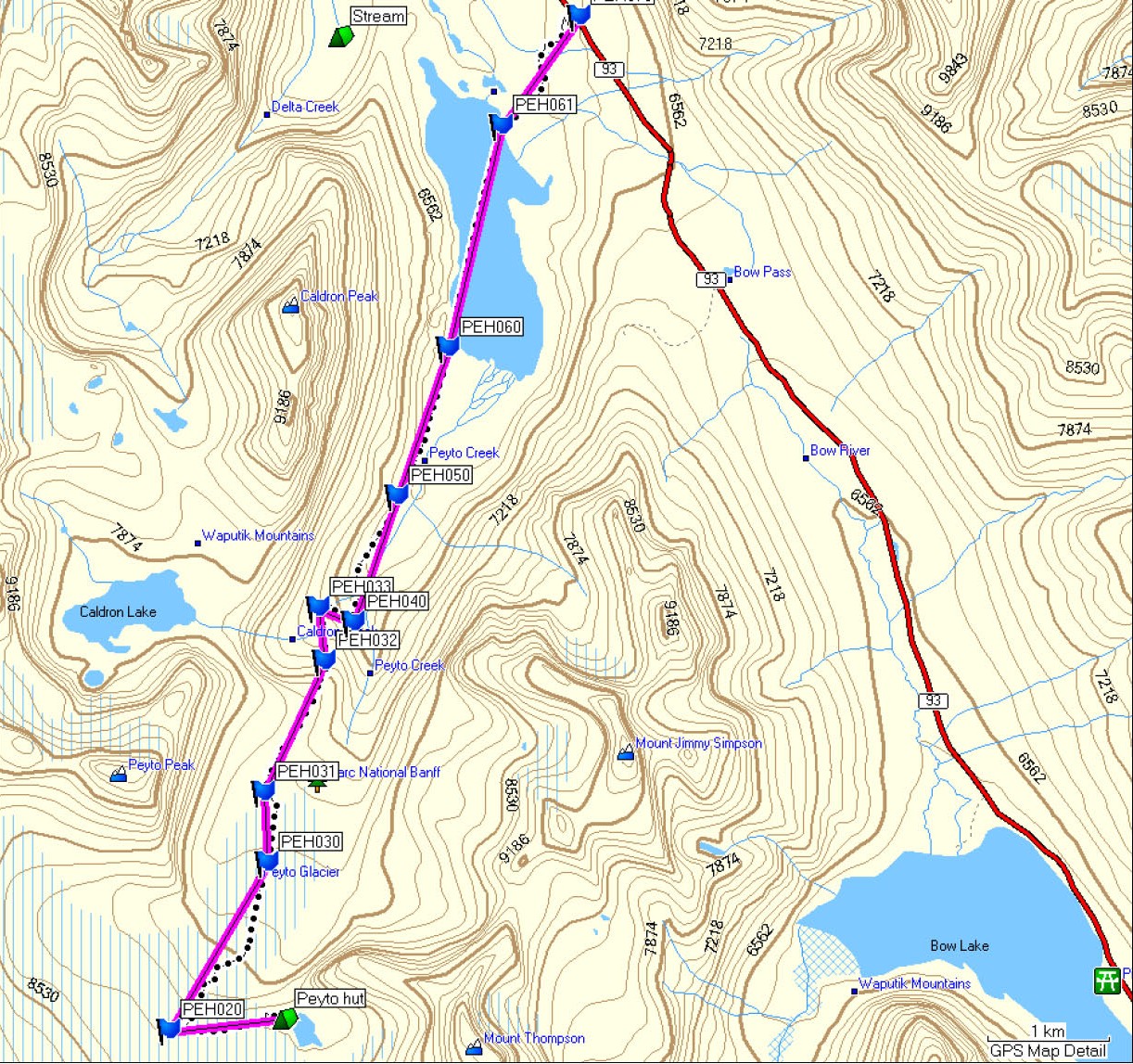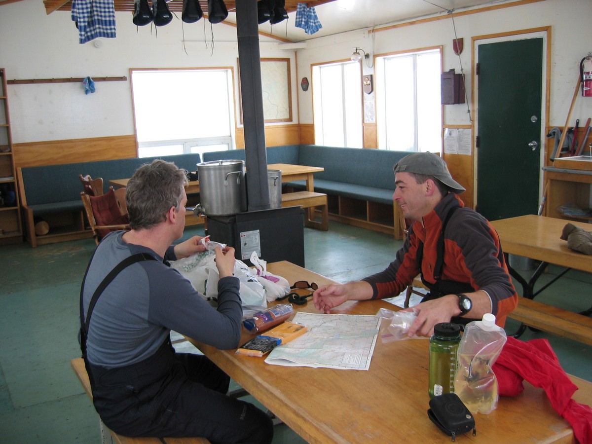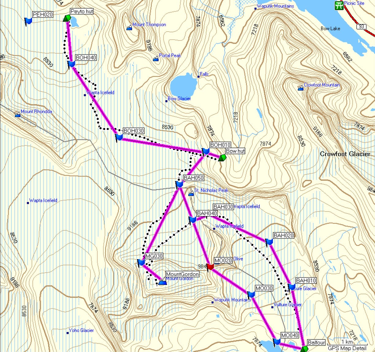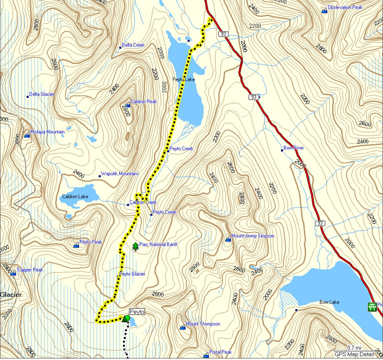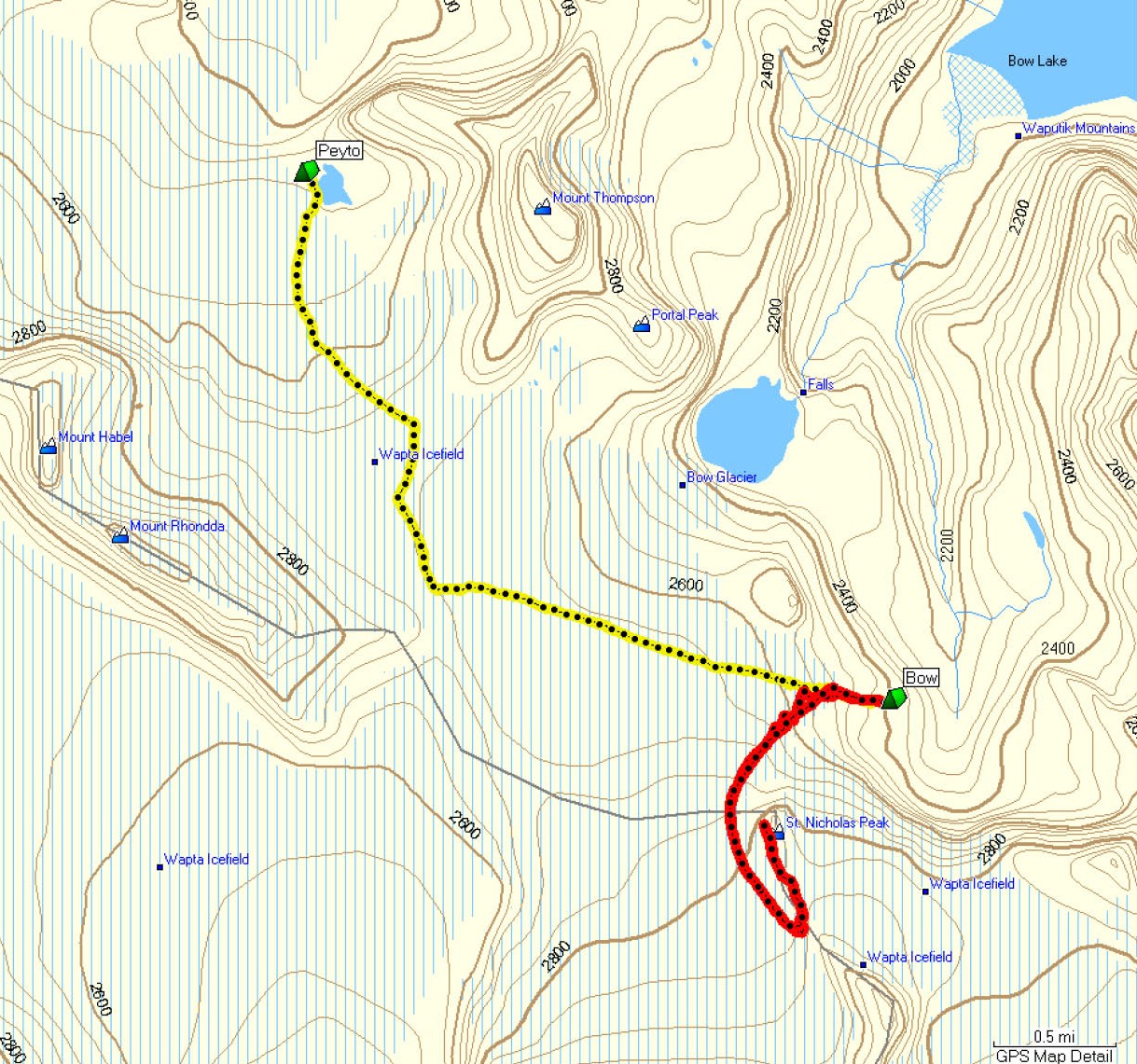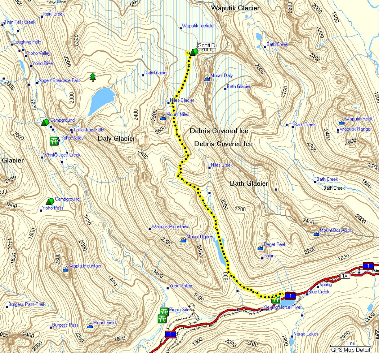
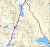
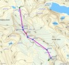
We started in the small parking pull-off about 2.5km beyond
Bow Pass.
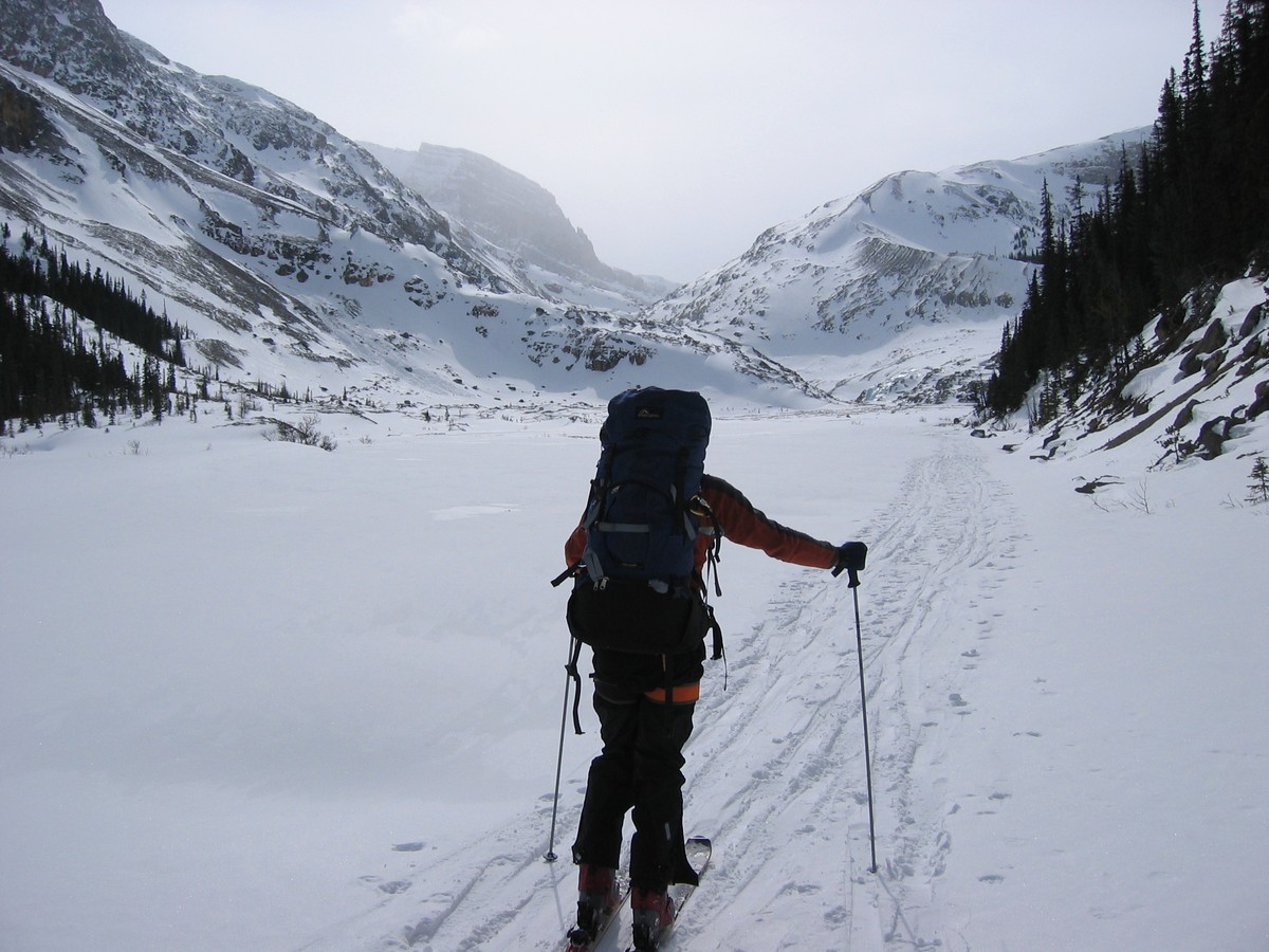
The first 1km was a narrow downhill trail with somewhat slick
conditions to the lake. Then across Peyto Lake and up along Peyto
Creek. We took the moraine route, up to the right of the Peyto Creek
gulley, because it is supposed to be less avalanche prone. (The rib up
the moraine can be seen in one of the pictures left. The start up the
rib to
the moraine is about 4.3km from the start of the lake and about 2.5km
from the end of the lake.) The climb up the rib was a little steep and
wind-blown in spots and was the most technical part of the whole
traverse. Then across the top of the moraine with a couple spots where
we had to take off skis because of rocky outcroppings. We had a short
down-hill to the glacier (avoiding an obvious crevasse) and then across
the middle of the glacier until it steepened. The hut is just over the
left steepest part of the glacier but we stayed in the middle or
towards the right on the climb up the steep part to avoid crevasses.
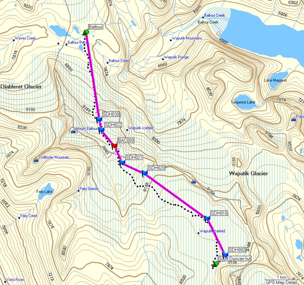
This meant we went up and then turned back (to the left) to access the
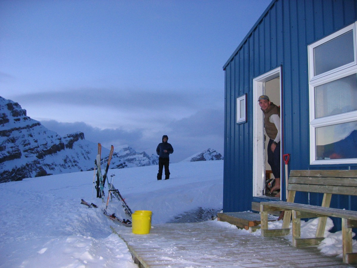
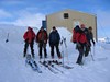
hut with a short climb. The hut coordinates given on the ACC site dit
not match what I got in the field so I substituted my reading.
11.5km, 2,640ft up, 730ft dn,
5:25
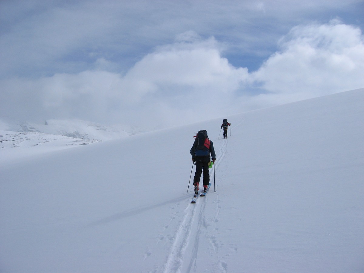
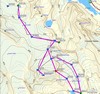
This was a pretty easy day. Visibility was OK to good. We
followed
other people's tracks up the glacier heading south, then turning a
little SE, for about 3 1/4 km from the hut. (We probably could have
headed a little
further south and gained a little more altitude to then glide down
towards the Bow hut.) Then we turned ESE towards the Bow hut. We were
warned not to turn east too early as that would take us down towards
the Bow glacier. In good visibility the key seems to be to wait to turn
E until you can see the St. Nicholas peak, and then go down under that.
The Peyto - Bow route was easy enough that I think we could easily have
gone Peyto - Balfour hut in one day (in decent conditions, of course).
6.8km, 1,100ft up, 1,330ft dn,
2:52
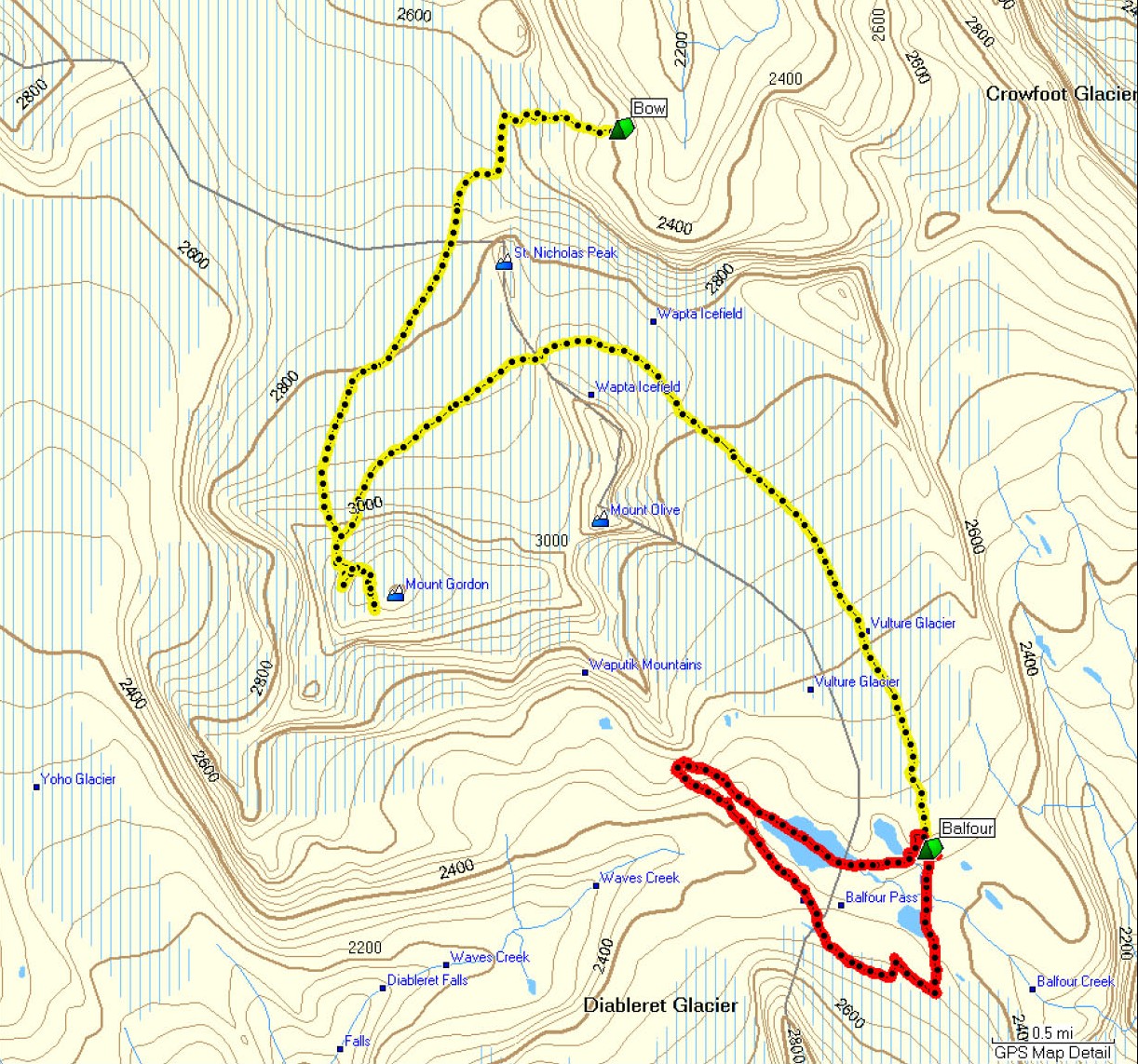
Day 2 & 3
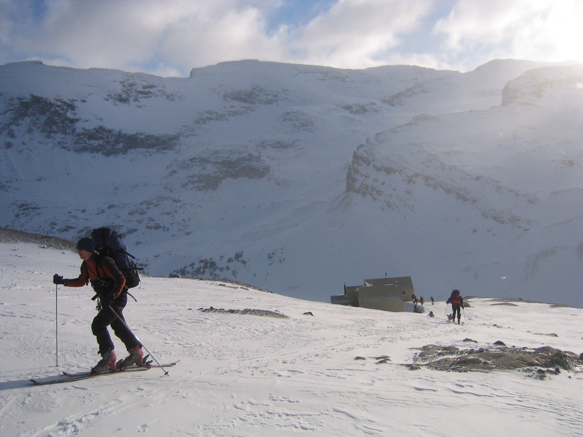
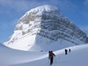
Again visibility was pretty good. We decided to climb Mt.
Gordon from
the south, a pretty gradual climb except for the last 20-30m. Views
from Mt. Gordon were very good and the ski back down to the glacier was
fun. (We ended up taking our full packs up, but we were warned about
the ravens if we stashed anything at the bottom. The ravens have
learned to get into packs and steal food, so we were told to bury
anything we stashed during a side-trip.) Three of our group went E over
the saddle between St. Nicholas and Mt. Olive onto the Vulture glacier,
then south but giving the crevasses on the east flank of Mt. Olive a
wide berth. (We were told that in poor visibility one can head east or
ESE from the saddle until one runs into the rock walls on the east side
of the glacier, then follow those south, to safely avoid the crevasses
under Mt. Olive.) The ski down the glacier towards the Balfour hut was
not really steep enough for fun skiing. We easily found the hut, but
again my GPS reading in the field did not match the coordinates on the
ACC site.
The direct route (without the ascent of Mt. Gordon) would be
about
8.3km with about 1700ft up and down. The other three of our group went
through the Vulture Col. This is supposed to be more avalanche prone
than the route through the St. Nicholas / Mt. Olive saddle (the SE face
of the col can get wind-loaded). Our group resorted to a belayed
ski-cut at the top. The snow at the top was hard, but lower down was
apparently good skiing.
12.9km, 2,880ft up, 3,030ft
dn, 5:09
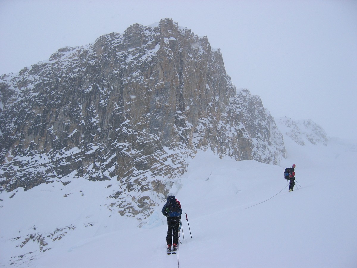
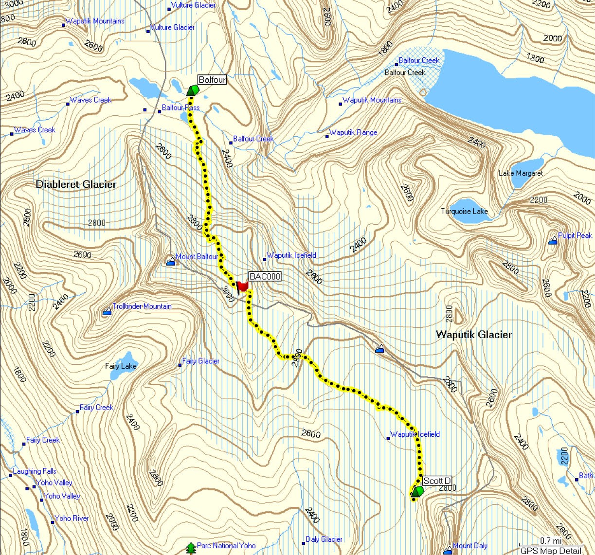
Day 2 & 3
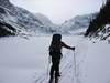
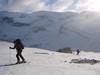
This is the route with the most objective danger, and
considerable
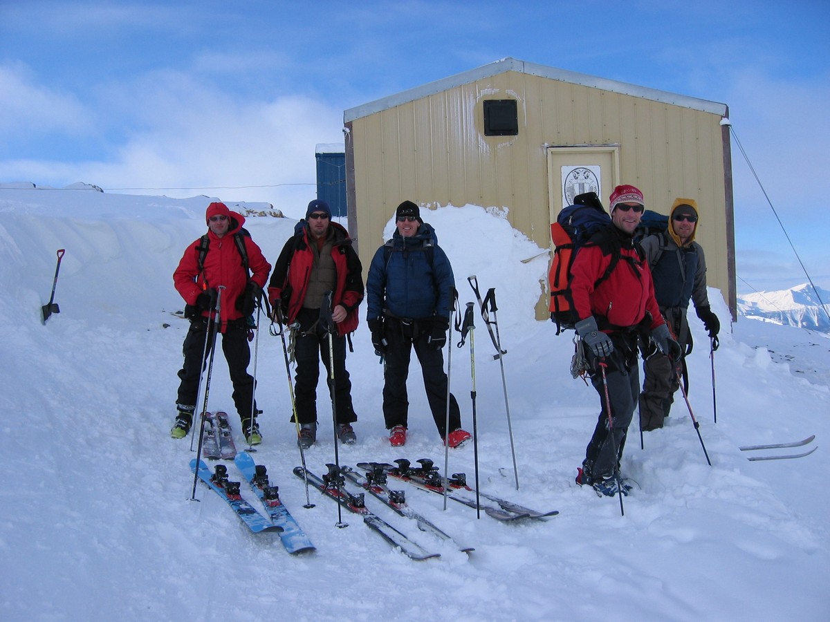
navigational difficulty in poor visibility. We started about 9:30 in
moderate visibility (you can see in the photos). We had plenty of
visibility for close navigation (avoiding crevasse, etc.) but not
enough to see distant land-marks. We were quite happy to be using GPS
with decent way-marks. We took the safer avalanche route (easterly
route up the ramp under and to the west of the nunatak). The
way-mark for the col was taken from an ACC accident report and proved
to be right on the mark. From reading trip and accident reports the key
here seems to be not straying east into a cliff area, and of course
visibility (worse than we had and we might have waited a day). The col
itself was wide, flat, and windy. The trek across the glacier to the
Scott Duncan hut was uneventful but slow in low visibility. In the end
we
probably should have stayed a little more east (left) - we lost a
couple hundred feet that we had to regain when we reached the hut. We
missed the easy ramp up to the hut that lies NNE of the hut (just under
Mt. Daly) and accessed the hut by a rocky route from below and south of
the hut.
11.2km, 2,510ft up, 1,510ft
dn, 6:37
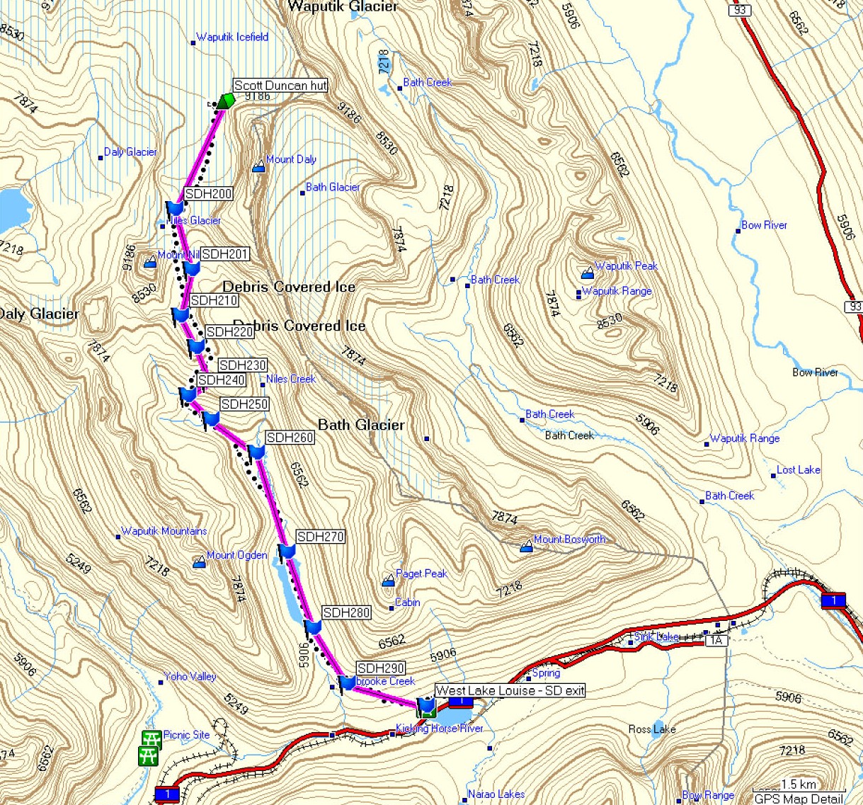
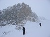
This was pretty easy, except for the steep descent through the
trees at
about 6km, and then the luge run in the final km.
Weather was clear and cold to start but by the time we got to Mt. Niles
it was warm. We started about 9 or 9:30, letting the guided group with
which we shared the hut for the night get ready and out first.
We took the bench above the Niles canyon (going between the nipple and
Mt. Niles) because of avalanche concern. There is a big crevasse or
hole just NW of the nipple and we were surprised to see a set of tracks
going between the hole and the nipple - the hole would be a horrendous
terrain trap if the steep slope of the nipple avalanched. We went
across under the east slope of Mt. Niles, and in the warm sun I would
have been happier to be a little further away from it.
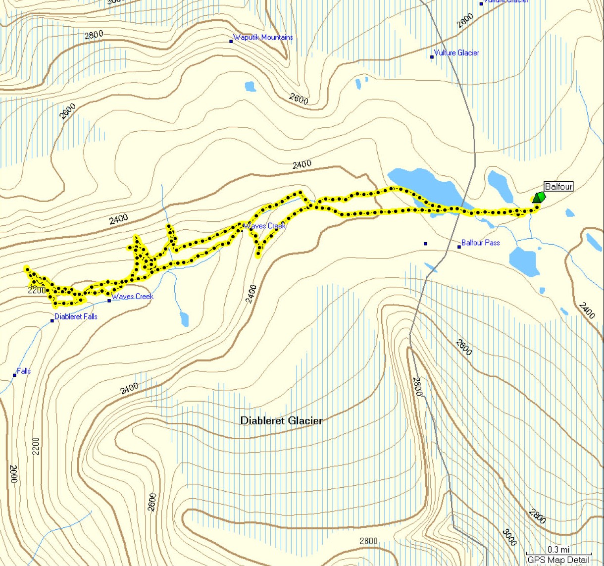
Once we got to the flats above Sherbrooke Lake it was just a
plod. I
ended up putting on skins for the most of the flat across the lake and
down the creek until the final km or two, which was a bit of a slick
luge run.
14.2km, 390ft up, 4,170ft dn,
3:52

GPS waypoints
in printed and downloadable format
(including the files listed just below).
You will want to use a program like
EasyGPS
to manipulate and transfer to the GPS unit.
Smaller
file (roughly 80kb) with GPS
routes and waypoints - no saved tracks.
Larger
file (roughly 1Mb) with GPS
routes, waypoints, and
saved tracks to allow comparision
of waypoints with the actual track recorded in the field.
Descriptions,
tracks, routes, waypoints, etc., were created for our
personal use and we make no warranties as to
reliability;
although we believe they are accurate they
should not be relied on by others.
To the left are files with GPS
tracks from our trip, plus routes and waypoints (.gpx GPS
eXchange format file). The hut
waypoints are actual readings from the field while all other waypoints
are
interpolated from the map and recorded tracks. You can use the program
supplied with your GPS unit, or (sometimes better) a shareware program
like EasyGPS (try Googling 'Easy GPS') to read and manipulate the .gpx
file.
One important point: Topographic maps apparently can be (and
often are) less accurate than GPS. I came to this conclusion from
examining the recorded waypoints and
routes, comparing with maps and reported waypoints, and researching
background information and speaking with experts
on mapping and GPS. (See
http://egsc.usgs.gov/isb/pubs/factsheets/fs17199.html for USGS
standards on map accuracy.)
As an example, the location of the St. Nicholas
peak recorded by GPS was about 80m west of that shown on two maps
I examined.
(The peak is at the northern end of a north-south knife-edge ridge,
making it relatively easy to identify the difference between the GPS
and map location.) Bottom line seems to be that topo maps, particularly
for remote areas where surverying by traditional methods is more
difficult, can have inherent uncertainty. Maybe not too surprising when
you consider that 100m on the ground (a large error with modern GPS)
translates to only 2mm on on a 1:50,000 map.
Note that this does not make me less likely to use a map or
less confident in relying on a map,
just cautious in how I use a map and GPS together.
In future I won't be too worried if my GPS position is
off from a map by 100m or 200m, and I still don't think GPS replaces a
good map (and compass).
A second point is that the coordinates for the huts as
reported on the ACC website (as of winter 2008)
are not perfectly accurate. Actual location measured in the field was
up to
370m distant from the coordinates reported on the ACC site. (This may
be related to the first point above. The coordinates may have
been digitised off a map and inherited the innaccuracy of the
underlying map. In addition, however, there appears to be some
confusion over geodetic datum - the ACC states their coordinates
for the Bow hut are NAD27, when analysis shows they are more likely to be NAD83.)
My measurements from the field, which appear to be accurate
within 20m or less, are as follows:
- Balfour hut: N51.59193 W116.46028 WGS84/NAD83 (11 U 537388
5715791 NAD83, 11 U 537469 5715581 NAD27) 367m distant from ACC
coordinates
- Bow hut: N51.63463 W116.48977 WGS84/NAD83 (11 U 535312
5720526 NAD83, 11 U 535392 5720316 NAD27) 100m distant from ACC stated
latitude / longitude (270m from ACC stated UTM coordinates)
- Peyto hut: N51.66585 W116.54576 WGS84/NAD83 (11 U 531415
5723972 NAD83, 11 U 531496 5723762 NAD27) 285m distant from ACC
coordinates
- Scott Duncan hut: N51.52815 W116.40270 WGS84/NAD83 (11 U
541434 5708729 NAD83, 11 U 541515 5708519 NAD27) 75m distant from ACC
coordinates
MAPS
The classic printed map (1:50,000) called "Touring the Wapta Icefields" - I found it at
www.canrockbooks.com
You can get custom-printed maps
(1:35,000) at
www.mytopo.com
You may even still find the maps I created at MyTopo - one for
north and one for
south